The True Source of Ancient World Maps

blog.genius-of-ancient-man_1
Picture from New Leaf Publishing Group


The True Source of Ancient World Maps

Maps of places all over the world began appearing as early as the 1300s. The maps included portions of North and South America, Central America, Antarctica, and Asia. Historians familiar with the maps have suggested luck, an unsolved mystery, and even space aliens as the sources for them. However, there is a logical explanation that begins with an account of history recorded in the Bible. There is every indication that a worldwide flood actually occurred about 4000 years ago, destroying the entire population of the earth except for Noah and his family.
Continue reading The True Source of Ancient World Maps

Crossing the Earth’s Oceans: 2000 B.C.

blog.Tori_Murden

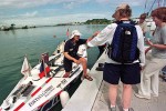
Would it surprise you to know that three women, Tori Murden in 1999, Julie Wafaei in 2006, and Katie Spotz in 2010, rowed solo across the Atlantic? In fact, the number of recorded times individuals or small teams have rowed across the Atlantic and even the Pacific Ocean is now in double digits. The first recorded account of a team of two people to row across the Atlantic was in 1896, completed without the help of modern electronics or tools.

The jingle “In 1492 Columbus sailed the ocean blue” is so ingrained in our thinking that it’s hard to imagine that Columbus wasn’t the leader of the first team ever to row or sail across the Atlantic. But, some compelling evidence indicates that many people traveled across the oceans and mapped the places they visited well before the time of Columbus.

Continue reading Crossing the Earth’s Oceans: 2000 B.C.